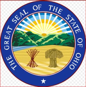
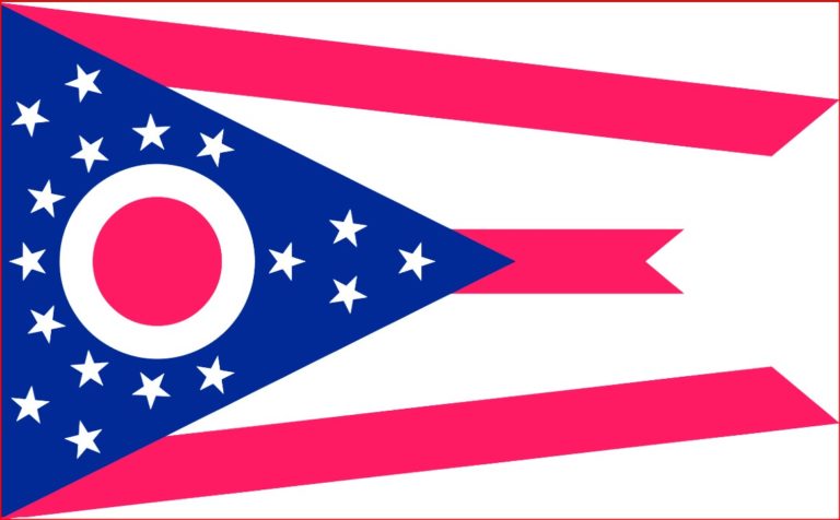
Ohio - Exciting and Diverse - Introduction
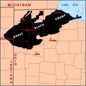
In order to understand Ohio today, it helps to review its geological past. Millions of years ago, this part of the world was tropical with vegetation that died and was compressed into coal, gas and oil. Ohio still has oil wells and coal mines. Starting east of Ohio is a vast, thick sheet of coal that in Pennsylvania and West Virginia lies close the surface. This sheet slants and gets progressively deeper as it lies under Ohio. Eventually it is so deep under the surface as to make mining not feasible. Thus, coal mining is in the eastern part of Ohio. During the ice age, two thirds of Ohio was under a mile thick glacier. As the climate warmed and the ice age ended, the southern edge of the glacier left much debris which formed Ohio’s hills. It also leveled the land, filling in canyons and much of the area with sand, silt, glacial till, gravel and clay. Ohio to the north of the glacial moraine become a flat and very wet prairie. Ohio was inhabited then by mastodons, mammoths, giant beavers, sloths, wolves, bears, and great herds of elk, deer and bison which roamed the area. Because it was wet and swamp in areas such as ‘The Great Black Swamp’, a glacially fed wetland that covered most of what is now north-west Ohio,and north-east Indiana. Ohio was not inhabited except for a few Native American villages along the major rivers. Ohio was a hunting ground for Native Americans until European settlement. Until the late 1700’s Ohio was still pretty empty. It would still be that way if it wasn’t for the introduction of clay tile from southern Ohio making it possible to drain the wetlands. Even today, as you drive in Ohio, glance at the edge of the road. The deeper the ditch, the wetter the area.
In 1832, settlement began in the Great Black Swamp on a sandy ridge which were once ridges formed along the edge of glacial lakes Maumee and Whittlesey which then drained to make the swamp. This sandy ridge became Bowling Green Ohio. The area was invested with wolves and mosquitos. The settlers built cabins and to get above the mosquitos, slept on the cabin roofs. Drainage of the area began after 1850. Today it is some of the best farmland in Ohio where major canning companies produce canned tomatoes, catsup and green beans. Unfortunately, agricultural runoff has polluted Lake Erie, creating toxic algal blooms. Today a series of deep ditches drains the area into the Maumee and Portage River watersheds. The swamp ran from Fort Wayne, Indiana east to near Port Clinton on Lake Erie, and south to Darke County and a corner of Auglaize County. Travel along the lake east of Toledo was nearly impossible. Travel anywhere in the swamp by horse-drawn vehicles was impossible most of the year.
At one time, all land west of the original 13 colonies was wilderness, the land occupied mostly by Native Americans and trappers. This vast wilderness was in the possession of countries such as France, England and Spain. Eventually, as mentioned in earlier chapters about the United States, wars, treaties, and purchases created what is now the United States. At one time, the area we now know as the state of Ohio was part of the French Territory which extended from Lake Superior to the Rocky Mountains. France gave control of the Ohio region to the British in 1763, but during the Revolutionary War, the area became part of British Quebec as the western theater of the war. After the Revolutionary War, the United States assumed control by the Treaty of Paris in 1783, and in 1787 formed the Northwest Territory, which included what all land west of Pennsylvania, north of the Ohio, west to the Mississippi and north to the Great Lakes. It included all or most what is now the states of Ohio, Indiana, Illinois, Michigan, Wisconsin and northeast Minnesota. In 1800 the Northwest Territory was reduced to the Indiana Territory, which included Ohio, eastern Michigan and southeast Indiana. On March 1, 1803, the southwestern portion of the Indiana Territory was admitted to the Union as the State of Ohio.