The Earth - Geography and Geology
Author: Robert W. Penry @ 2023
The pictures below access pages or sections in this website. Just click the picture!


Our World - the Planet Earth

THE NATURE OF OUR WORLD – DISCOVERY
In ancient times, man had no concept of our world. Many thought the earth was shaped like a saucer, flat and if your reached the edge, you could fall off. The sun sank below the rim and traveled underneath, coming up the next morning above the other edge. This explained why the sun arose in the east and set in the west. Some believed the earth rested on the back of a giant turtle! To man, the earth was at the center of the universe and all stars rotated abound the earth. Eventually through observation and exploration, man determined the earth was round – a globe, but had no concept of its size. As men began exploring, the size began to be understand. Travel began to be measured in days and by positions of the sun and other heavenly bodies. Instruments were invented making this possible. Men began exploring, finding new lands. Marco Polo discovered China. Christopher Columbus probably landed on Hispaniola thinking he was in China. We know that Vikings actually landed in the Americas before Columbus. Ideas of the universe expanded when men like Galileo, Newton and Darwin changed how we view the world and life itself. As exploration continued over many centuries, the globe began to be mapped and eventually we became to understand more and more about the wonderful world we live in.
SECTION I – CHARACTERISTICS
The Earth is a water world. It is covered by vast body of water known as the Great Ocean. However, it is not a smooth planet. Under the water are huge canyons, mountains, plateaus, and volcanos. Sometimes these features rise above the water’s surface as land both continents and islands.
The Earth is also a world of fire. Below its surface in both water and land, lie cracks and weak spots in a layer of the earth, we call its crust. The earth is round like an orange. Its crust is like the skin of the orange. The Earth’s crust is between 18.6 and 43.5 miles thick. Below the crust lies molten rock. In weak spots in the crust, the molten area below protrudes through the crust and creates fiery protrusions, we call volcanos. These can exist in both water and land. The volcanos can sometimes erupt, spilling out molten rock, and grow larger, or explode and almost disappear.
The Earth is also a living planet. Besides the water and the land, the earth is also surrounded by a layer of gases about 60 miles thick. This layer contains oxygen, an element necessary for life. Oxygen also exists in the water. Living creatures can exist in the water, the land, and the air. In the water, we have life that can swim or float. On land, we have life that can walk or crawl. In the air, we have life that can fly. On land and water, we have life that doesn’t move at all such as flowers, grass, shellfish and coral.
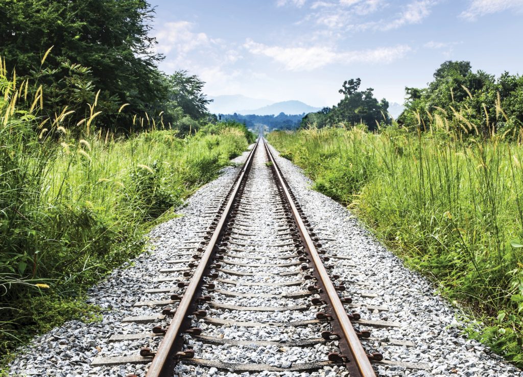
The Earth uses Time, Distance, and Location. Consider this problem. The distance from Chicago to New York City is 790 miles by rail. A train leaves Chicago at 10:00 a.m. EST traveling an average speed of 55 mph enroute to New York. A train leaves New York at 10:30 a.m. EST at an average speed of 70 mph enroute to Chicago. At what location and at what time do the trains pass? (The formula is: If two trains leave x and y stations at time t1 and t2 respectively and travel with speed L and M respectively, then distanced from x, where two trains meet is = (t2 – t1) × { (product of speed) / (difference in speed) Time/Distance/Location are related. Occupancy indicates who or what is at a particular location. (Click the picture links above to read about Time, Distance, Location, or Occupancy)
Time
Since living creatures rove across the surface of our planet, one creature, with the ability to reason. needed to understand direction and time to travel. That creature was man. Men realized that they needed to divide up the planet into recognizable areas. So, man began naming areas and features of the planet (and also names for the living creatures). Men also needed to know how long it took to travel from one point to another, so time itself needed to be defined.
Men observed that features in the sky such as the sun, moon and stars appeared to move in determined cycles.
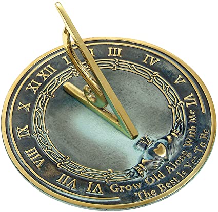
In ancient Egypt, men invented shadow clocks (sundials) and placed 12 equally spaced marks from dawn to dark. The dark divisions were based on the observation of stars. These distances came to be known as hours and thus the 24-hour day was defined.
The Babylonians decided to break the hour into sixty minutes and the minute into sixty seconds because their number system (sexagesimal) or counting in units of 60 was used for mathematics and astronomy. They borrowed this number system from the Sumerians who developed it about 3500 BC.
Maps and Survey
In ancient times throughout the world, map-making was primitive. Borders were established by landmarks. The earth was not divided by latitude and longitude with meridians, parallels, minutes and seconds. A tribe might exist on one side of a stream and consider the stream itself as no-man’s land. A bay, a mountain, a mountain range or a road might form a visual border. People cleared land to establish ownership boundaries. As a community grew, its borders increased.
This method of determining borders by natural features in survey is called metes and bounds and was used extensively in Britain and in many parts of American colonies. Later on, the survey of land was done by compass direction using chains and rope called chain survey. Egypt used a form of chain survey to lay out the lines for building pyramids.
Many neolithic boundaries were often based upon angles to the sun or moon. Many tombs and standing stones such as Stonehenge were built this way.
We still use metes and bounds for legal purposes. Example: Beginning at a point from which the north quarter corner of Section 4, T. 1 N (township 1 north), R.70 W (range 70 west) of the 6th PM (the sixth principal meridian, a north–south reference line) in Sample County Sample State, bears N 45° W 1,320 feet, at which point of beginning an iron stake has been placed; thence south 600 feet to a point also marked by an iron stake; thence N 45° W 700 feet to a large oak tree; thence northeasterly to the point of beginning. This was an actual survey referenced on an article on survey techniques.
Tools have changed for doing surveys including satellite imaging, photographs, and expensive equipment on tripods, but legal descriptions and deeds are by metes and bounds.
Unfortunately, because of legal disputes or movement or destruction of natural landmarks, boundaries can change. Some are even humorous. Examples are:
- The Mississippi Rever is known for meandering, forming numerous oxbow lakes and cutoffs. Because of an oxbow, the State of Mississippi which is located on the east side of the river, now has a small piece of land west of the river in Arkansas.
- Lookout Mountain City, Walker County Georgia is located on Lookout Mountain which straddles Georgia and Tennessee. The county extends beyond the mountain down a vertical cliff. There is no road down into Georgia. To get to any other location in Georgia, a resident of Lookout Mountain City must travel down into Tennessee, then around the mountain into Georgia!
- The Haskell Free Library and Opera House was built in 1901 by a wealthy American merchant’s Canadian wife on the international boundary between Derby Line, Vermont and Stanstead, Quebec. It has entrance/exits in both countries. While in the library the boundary doesn’t apply, but you must enter and exit from/to your own country. It is said that the 18th century surveyors were drunk and missed border locations by as much as a mile. Nobody in the region really cared and ignored the border while shopping. However, 9/11 changed that and the border is enforced by nine pots of pink and purple petunias and a sign ordering people not to cross. The people of Derby Line and Stanstead consider themselves neighbors but were dismayed by the feud between President Trump and Prime Minister Trudeau.
Distance and Location
This is a good start to announcing our location, but it is not accurate enough. We need to divide the degrees more. So, we divide each degree into 60 units we call minutes and then divide each minute into 60 units we call seconds, then each second is divided into 1000 units. When we travel, we often divide distance into how much time it takes to cover the distance. Since distance and time are related. minutes and seconds for distance made sense.
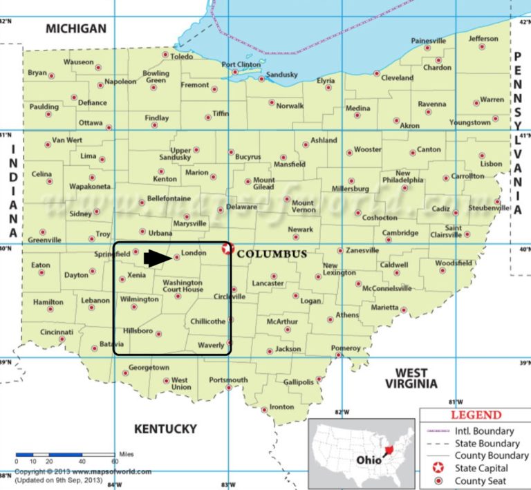
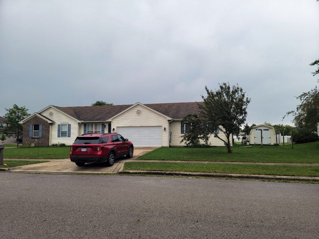
N 39°54’1.361” W 83°26’30.922” is where I am right now as I am typing this. That set of coordinates is the location of my house on the planet Earth – London, Ohio, United States of America, Northern Hemisphere, Western Hemisphere. It is accurate to a block of land 16 by 33 feet. Considering this is a single point on an entire planet, it is very accurate. We have GPS units that we can carry or perhaps our vehicle has GPS that can measure to an even higher level of accuracy.